


Lac de Lispach, lac de la Ténine, Boule du diable - XVD

xaviermimi
User
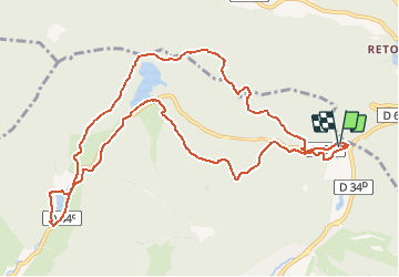

Length
11.5 km

Max alt
1091 m

Uphill gradient
346 m
Km-Effort
16.1 km

Min alt
855 m

Downhill gradient
345 m
Boucle
Yes
Creation date :
2020-09-16 13:38:28.901
Updated on :
2020-09-27 08:14:41.941
3h14
Difficulty : Easy

FREE GPS app for hiking
 SityTrail
IGN / Geographical institutes
SityTrail Plus
The world is yours!
About
Trail Walking of 11.5 km to be discovered at Grand Est, Vosges, La Bresse. This trail is proposed by xaviermimi.
Positioning
Country:
France
Region :
Grand Est
Department/Province :
Vosges
Municipality :
La Bresse
Location:
Unknown
Start:(Dec)
Start:(UTM)
349006 ; 5323567 (32U) N.
Comments